A Historical Perspective of the Leesville/Smith Mountain
Project and Virginia’s Upper Piedmont Plateau
CONTRIBUTED BY LOU REVELLE
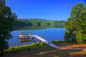
Leesville and Smith Mountain Lakes were created by the American Electric and Power Company (AEP) along the Roanoke River in the early 1960’s for the purpose of flood control and hydropower. In our region, this river flows around rolling hills and through fertile scenic valleys on its way to the Albemarle Sound of North Carolina.
EARLY PEOPLES
The record of man’s presence in this part of Virginia is rather complex. Archeological evidence suggests that early people had inhabited Southwestern Virginia since the last Ice Age or about 15,000 to 18,000 years ago and artifacts of Paleo cultures have been found at the Smith Mountain and Leesville Dam sites. By cultural evolution and immigration of other Native American groups, the makeup of the Native Virginians eventually divided into three distinct groups as recorded by early Spanish and English explorers: The Iroquoian speaking Cherokee of far Southwest Virginia, the Siouan speaking Monacans, Saponies, and Tutero of the Piedmont and the Coastal Powhatans of the Algonquian dialect.
Early 16th Century records indicate the presence of Spanish explorers who considered our area part of Florida. The middle 17th century was a time of intense English exploration, principally by Lederer (1670) and Batts (1671) who made contact with the Sapony people in what is now Campbell County.
COLONIZATION
Protection of the Virginia Colony from French ambitions west of the Blue Ridge, ending of frequent disputes with hostile Indians, and a need to move the production of tobacco from the depleted soils of Tidewater into the fertile Piedmont represented just a few of the driving forces that resulted in the settlement of the Roanoke Valley. To attract settlers, many Colonial Governors were eager to award land patents and assurances of religious tolerance exclusive of the established church. Large tracts of land were extended to those who had served in any form of military or militia service, and in some instances a person was given land for an act as simple as disembarking a ship from the mother country. Special land patents were available to those wanting to raise tobacco. Lynchburg and Brookneal, in Campbell County, began as major tobacco warehouses after 1780, and the labor of our area was devoted to the cultivation of that single crop.
Land was plentiful, practically free for the asking, and in this atmosphere the 18th century Roanoke Valley was thereby settled.
RIVER OF TWO NAMES
The Roanoke, an Algonquian word used by early English explorers to describe the river, is also called the “Staunton”, a variant name to which local residents have become fond. The name was given to the Virginia portion of the Roanoke around 1728 by William Byrd II, to honor the wife of Royal Lieutenant Governor William Gooch, Lady Rebecca Staunton Gooch. Although not an official name of the river, Commonwealth of Virginia Officials decided to leave the Staunton River signs in place, after efforts to standardize the signage in 1939 resulted in Roanoke River signs (in the local area) being continuously vandalized.
HYDROPOWER ALONG THE ROANOKE
In 1927 the United States Army Corps of Engineers conducted a comprehensive survey to determine the need for flood control, irrigation and hydropower projects in the Roanoke Basin, however, due to a lack of government funding, the projects did not move forward. After a devastating flood in 1940, which nearly eradicated the North Carolina towns of Roanoke Rapids and Weldon, the Corps of Engineers reexamined their earlier survey and recommended a series of eight flat water reservoirs along the Roanoke to help prevent such a catastrophic event from reoccurring. Acting under authorization of the Flood Control Act of 1944, the Corps of Engineers (along with Congressional help of John H. Kerr) in 1944, began construction on the sister projects of Kerr and Philpott Reservoirs, both in the Roanoke watershed.
It is interesting to note that private companies such as AEP and VEPCO (Dominion today) were not allowed to begin hydro projects on the Roanoke during the late 1940’s and early 1950’s. Although the Federal Power Commission granted permits to VEPCO, the Department of the Interior under the Truman Administration would not allow construction to begin. The Interior Department felt that the Flood Control Act of 1944 gave the Federal Government exclusive rights to build dams and generate electricity. In a Supreme Court Case, placing VEPCO and the FPC against the Department of the Interior, the Warren Court ruled, in the Spring of 1953, that VEPCO had a right to build a hydropower facility at Roanoke Rapids, N.C. Construction of the dam began the day after the court’s ruling, and less than a year later, VEPCO began construction of the Gaston Dam. Before the end of the 1950’s AEP would begin initial stages of construction of the Leesville Smith Mountain Pumped Storage Project. The project was completed in 1966. In anticipation of building a dam at the Smith Mountain Gap, predecessors of AEP had previously purchased tracts of land in the Smith Mountain area.
Free of the bottleneck of Federal bureaucracy, the Leesville/Smith Mountain Project became a reality.
– Lou Revelle

